- Saturday, 20 April 2024
Nepal's land divided in 11 categories

Kathmandu,
April 24 (RSS): The government has
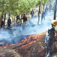
classified the land into 11 different categories. Based on the National Land
Cover Monitoring System (NLCMS) which was launched Saturday by the Ministry of
Forests and Environment, the land has been categorized as forested land, agricultural
land, grassland, bush, marshland, snow land, glacier, rock, flood land, shelter
land and vegetation-less land.
The Ministry had approved
the NLCMS on March 21 and it was launched on Mother Earth Day on April 22.
NLCMS aims to carry out monitoring and preparing reports every year by using the
maps and photos taken from a satellite.
The system uses cloud
computing and artificial intelligence to generate consistent data on how much
of a region is covered by forests, wetlands, agriculture, and other land and
water types, on an annual basis.
Ministry spokesperson
Meghnath Kafle shared that the land cover map from 2000 to 2019 has been
prepared according to the national, provincial and geographical areas by using
this system.
According to the land over the map, forest cover was 39.99 per cent in 2000 and it reached 41.69 per cent in
2019. Similarly, the agriculture area decreased from 26.31 per cent in 2000 to
24.21 per cent in 2019.
Data and information on the
situation and distribution of forest, agriculture, pastureland, water bodies
and settlement areas are considered important basic sources for sustainable
development.
The NLCMS will improve
reporting on forest cover change and support Nepali lawmakers in making
evidence-based policies to improve related land management practices. The
Forest Research and Training Centre (FRTC) developed the NLCMS with support
from the Survey Department, SERVIR-HKH, a joint initiative of the United States
Agency for International Development (USAID), the National Aeronautics and
Space Administration (NASA) and the International Centre for Integrated
Mountain Development (ICIMOD).
How did you feel after reading this news?
-original-thumb.jpg)


-original-thumb.jpg)